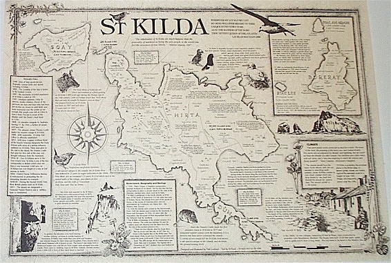
St Kilda Map
St Kilda (Scottish Gaelic: Hiort) is an isolated archipelago 64 kilometres (40 mi) west,northwest of North Uist in the North Atlantic Ocean.
It contains the westernmost islands of the Outer Hebrides of Scotland. The largest island is Hirta, whose sea cliffs are the highest
in the United Kingdom and three other islands (Dùn, Soay and Boreray), were also used for grazing and seabird hunting - St Kilda has one
of the most important seabird colony's in Europe.
This map is hand drawn and offers insights into the historical, archaeological, geographical, natural history and culture of the area.
The map is A2, 420mm x 600mm approx, 16.5" x 23.5" approx. It is printed in black on quality parchment paper and supplied rolled in a postal tube.
landscape size A2 $40
APOLOGIES SOLD OUT
Scottish Map