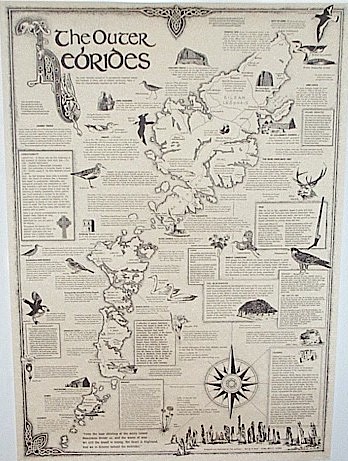
Outer Hebrides Map
The Outer Hebrides ( also known as the Western Isles and the Long Island,
is an island chain off the west coast of Scotland. The islands are geographically contiguous with Comhairle nan Eilean Siar, one of the
32 unitary council areas of Scotland. They form part of the Hebrides, separated from the Scottish mainland and from the Inner Hebrides by
the waters of the Minch, the Little Minch and the Sea of the Hebrides. Scottish Gaelic is the predominant spoken language, although in a few
areas English speakers form a majority.
This map is hand drawn and offers insights into the historical, archaeological, geographical, natural history and culture of the area.
The map is A2, 420mm x 600mm approx, 16.5" x 23.5" approx. It is printed in black on quality parchment paper and supplied rolled in a postal tube.
