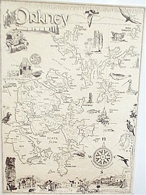
Orkney Map
Orkney (Scottish Gaelic: Arcaibh) also known as the Orkney Islands (and sometimes "The Orkneys", a name which locals disparage)
is an archipelago in northern Scotland, 16 kilometres (10 miles) north of the coast of Caithness. Orkney comprises approximately 70 islands of
which 20 are inhabited. The largest island, known as the "Mainland" has an area of 523.25 square kilometres (202.03 sq mi) making it
the sixth largest Scottish island and the tenth,largest island in the British Isles. The largest settlement and administrative centre
is Kirkwall.
This map is hand drawn and offers insights into the historical, archaeological, geographical, natural history and culture of the area. The names of the birds
are shown in latin and in local name given to them in Orkney. The map is A2, 420mm x 600mm approx, 16.5" x 23.5" approx. It is printed in black on quality parchment paper and supplied rolled in a postal tube.