Ordering
For postage prices please see our shipping page.
For delivery to a UK address please order from our sister site Tartan Rock UK coming soon tartanrock.eu
Import duties, taxes, and charges are not included in the item price or shipping cost. These charges are the buyer's responsibility.
Cookies
The cookies we use on our site are for the functioning of our shopping cart and Google Analytics
to collect information about how visitors use this site and if issues are encountered such as broken
links. To opt out of Google Analytics click here
Best Selling Items
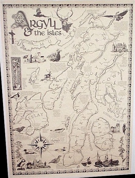
Argyll and the Isles Map
Argyll & The Isles is west of Glasgow and stretches west from Loch Lomond,
north to Oban and south to Machrihanish. Argyll contains a number of smaller regions including Cowal, Kintyre, Mid Argyll, North Argyll and
islands.
This map is hand drawn and offers insights into the historical, archaeological, geographical, natural history and culture of the area.
The map is A2, 420mm x 600mm approx, 16.5" x 23.5" approx. It is printed in black on quality parchment paper and supplied rolled in a postal tube.
Portrait - size A2 $40
Scottish Maps
