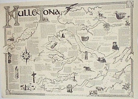
Mull and Iona Map
The Isle of Mull or simply Mull (Scottish Gaelic Muile, is the second largest island of the Inner Hebrides, off the west coast of Scotland in the council area of Argyll and Bute.
They were created from a volanic eruption millions of years ago.
With an area of 875.35 square kilometres (337.97 sq mi) Mull is the fourth largest Scottish island and the fourth largest island surrounding Great Britain.
In the 2001 census the resident population of Mull was 2,667; in the summer this is supplemented by many tourists. Much of the population lives
in Tobermory, the only burgh on the island until 1973, and its capital.
Visitors can reach Iona by the 10, minute ferry trip across the Sound of Iona from Fionnphort on Mull.
This map is hand drawn and offers insights into the historical, archaeological, geographical, natural history and culture of the area.
The names of the native birds and flowers are written in latin and in Gaelic.
The map is A2, 420mm x 600mm approx, 16.5" x 23.5" approx. It is printed in black on quality parchment paper and supplied rolled in a postal tube..